High-Precision Positioning Solutions
Do More. Spend Less. Miss Nothing.
When every inch shows up on your profit and loss statement, “good enough” gets expensive fast. EdgeBeam delivers real-time kinematic (RTK) correction data over a hybrid terrestrial network, giving machines and devices steady, centimeter‑level location data so teams cut rework, save fuel, and finish jobs on budget.
Benefits
Turn High-Precision Positioning Into Smoother Days and Stronger Margins
When the precision of your location data is solid, work moves the way it should. Machines and devices stay aligned, work finishes in fewer trips, and days end closer to plan than to overtime. Teams can trust what they see on their screens, move with confidence, and keep high‑value work flowing instead of stopping to second‑guess every move.
EdgeBeam’s custom solutions for high-precision positioning make that kind of consistency repeatable at scale. Our hybrid terrestrial network delivers RTK corrections to many Global Navigation Satellite Systems (GNSS) receivers at once, so machines and devices get synchronized, centimeter‑level updates without teams managing base stations or chasing spotty links. You get a simpler, more economical way to keep equipment aligned, projects moving, and margins where you want them.
Convert Passes Into Profits
Finish more work in fewer passes with steady, centimeter‑level RTK data.
Keep Your Signal Steady, Always
Hybrid RTK delivery keeps corrections flowing, even when other networks drop out.
Grow Your Fleet, Not the Chaos
Add machines, devices, and job sites without changing how you deliver RTK corrections.
The Fast Lane for RTK Corrections at Scale
In the illustrated example, global positioning system (GPS) reference data flows to the cloud, then out over our hybrid terrestrial network. Broadcast and cellular paths work together to deliver synchronized, reliable RTK corrections to your receivers.


Use Cases
Bring Centimeter‑Level Confidence to Every Job, Field, and Route
How reliable RTK is used is different in every industry, but the need is the same. EdgeBeam’s custom high-precision positioning solutions deliver consistent, centimeter‑level updates to machines, crews, and vehicles across jobs, fields, sites, and routes.
Construction
RTK corrections are already standard on most job sites today.
EdgeBeam simply makes them easier to deliver.
Our hybrid, terrestrial network sends correction data to users in the field, so crews get centimeter‑level positioning for layout, grading, paving, utilities, and as‑built documentation without needing to stand up local GNSS bases or pay premium network RTK rates. You get faster stakeout, smoother machine control, fewer costly mistakes, and projects that stay closer to plan and budget.
View Relevant Construction Devices
Machine Control
Construction sites and open‑pit and quarry operations alike push networks to their limits.
EdgeBeam’s hybrid terrestrial network delivers RTK corrections into these remote, complex environments so haul trucks, drills, dozers, and survey crews all share the same precise positioning picture. Machine control, pit and highwall mapping, and early autonomy projects benefit from robust, wide‑area accuracy that is less sensitive to terrain and local infrastructure. That means fewer positioning‑related errors, safer operations, and less expensive downtime when every hour of production counts.
View Relevant Machine Control Device
Agriculture
In the field, a few inches decide whether you’re wasting inputs or maximizing yield.
EdgeBeam provides RTK corrections over a hybrid terrestrial network so tractors, sprayers, and combines can steer with centimeter‑level accuracy and repeat the same lines season after season. Autosteering, precision planting, guidance, and drainage mapping all benefit from a more reliable signal that doesn’t depend on temporary bases. Farmers see less overlap and skip, better input placement, and more productive passes across every acre.
View Relevant Agriculture Devices
Surveying
Surveyors need both accuracy and speed, not one or the other.
EdgeBeam distributes RTK corrections broadly over a hybrid terrestrial network so GNSS rovers can produce real‑time, centimeter‑level positions in the field. Boundary surveys, topo work, elevation checks, and as‑builts all move faster with less dependence on long post‑processing sessions or fragile local bases. Firms can cover more ground per crew, improve reliability in challenging locations, and control recurring RTK delivery costs over time.
View Relevant Surveying Devices
UAV/eVTOLs
When unmanned aerial vehicle (UAV) and electric vertical take-off and landing (eVTOL) operations scale, location errors quickly show up as safety risks and higher costs.
EdgeBeam streams RTK corrections over a hybrid terrestrial network so UAVs, eVTOLs, and autonomous vehicles get precise, consistent positioning even as the number of devices grows. Better location data reduces reliance on expensive onboard sensors like LiDAR and cameras, strengthens navigation and collision‑avoidance stacks, and supports new services such as predictive maintenance, asset tracking, and usage‑based insurance without the RTK feed becoming a bottleneck.
View Relevant UAV/eVTOL Devices
Ready To Get Precise?
Talk to our team to see what centimeter-level accuracy can do for your operations →
Customer Testimonial
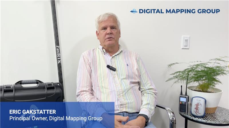
Increasing RTK Connectivity to Boost Field Productivity
Digital Mapping Group Principal Owner Eric Gakstatter discusses the importance of reliably transmitting RTK corrections data, calling connectivity “the Achilles’ heel of RTK, because it either works or it doesn’t, and if it doesn’t work, users get frustrated.” As an EdgeBeam customer, Eric views devices that seamlessly switch between wireless and ATSC 3.0 networks as geospatial game-changers for field productivity. Watch the video to learn more.

Devices
Built for Precision. Backed by EdgeBeam
EdgeBeam makes centimeter-level precision possible at the edge, and the right device is what puts that precision to work. The devices featured here are built by trusted vendor partners, each selected to work seamlessly with EdgeBeam’s patented technology, hybrid ground-based network, and custom high-precision positioning solutions.
View DevicesResource Center
Stay on the Edge of What’s Next With Insights for Modern Connectivity
Get the essentials on expanding capacity, reducing congestion, and scaling enterprise data delivery. Guides, POVs, and use cases built for real-world networks.


Join the EdgeBeam Partner Network
Deliver more value for your customers and unlock new revenue as a partner.
Partner With UsFrequently asked questions (FAQs)
Get Answers to FAQs About EdgeBeam’s Solutions
Standard GPS gets you close, within 3 to 10 meters. EdgeBeam delivers centimeter-level accuracy by transmitting RTK correction data over a hybrid ground-based network, giving machines, vehicles, and crews the precise location data they need to operate without error or rework.
Not at all. Whether one vehicle or one million are using EdgeBeam’s RTK corrections simultaneously, the service never slows down. That’s the advantage of one-to-many delivery: scale doesn’t come at the cost of performance.
No. EdgeBeam eliminates the need to set up your own local GNSS base stations or rely on expensive traditional network RTK providers. Your crews get centimeter-level RTK corrections delivered directly over EdgeBeam’s network, with less setup, lower cost, and more time spent working.
Yes. If you’re already using an RTK service you’re happy with, EdgeBeam can provide an alternative delivery method for your RTK corrections that dramatically reduces connectivity costs and improves reliability. We’ve integrated our solution with most of the major providers in the GNSS space so you keep the service you trust, but with better performance and lower cost.